


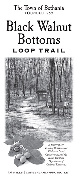
Click for PDF Trail Map
This 1.4 mile trail runs through protected land in the Bethania National Historic Landmark District. Parking lot for the Bethania Town Hall and Visitors Center offers plenty of free spaces for walking all the trails around Bethania. Black Walnut Bottoms trail starts at the right side of the Town Hall where some steps descend a bank and lead to a kiosk (information sign). This trail includes nine-tenths of a mile loop in Black Walnut Bottoms, crosses five foot bridges and leads to Muddy Creek, colonial era agricultural fields and the base of hard wood covered Black Walnut Bluffs.
Trail Directions: Pass the trail head kiosk and trail head sign for Black Walnut Bottoms Trail. The “infinity” type symbol at the top of the sign is the same symbol that the Moravian Surveyor Christian Reuter used to designate bottom-lands on a 1767 map of Bethania.
Follow a level path through the bottom land woods, and at one-tenth of a mile pass a carved stone that explains how the 60 acres of land where the trail runs were protected by a combination of funding from the North Carolina Natural Heritage Trust Fund and gifts of land or land value made by families that owned the land.
After another 90 feet, reach a fork in the trail. This fork is the beginning of a short 0.15 mile loop that can be used for a shorter loop walk. Bear left at that fork, and reach a foot bridge that crosses a drainage ditch after another 350 feet. Turn left and walk across the bridge to continue on the 1.4 mile Black Walnut Bottoms Trail. One continues straight (and do not cross the bridge) to stay on the shorter 0.15 mile loop.
Continuing on the Black Walnut Bottoms Trail, one crosses a field and at 0.25 miles reaches Bear Creek and the footbridge across the creek. After another 50 feet, reach a split in the trail and bear left. The 0.9 mile loop through Black Walnut Bottoms begins here.
Walk a level path through the ash trees that grow in the Muddy Creek flood plain bottom and note stands of tall reeds to the right near Muddy Creek. 1750-era Moravian Records note the presence of large stands of reeds along Muddy Creek and how the reeds could serve as forage for cattle kept by the first settlers in Bethabara.
At 0.4 miles pass a bench, a nice view of Muddy Creek and a sign that reads “Muddy Creek”. After another 100 feet, cross a footbridge over a drainage ditch that was hand dug by early Moravians when they drained the bottom lands to make them suitable for farming.
Cross two smaller drainage ditches and part of a large field and at 0.5 miles, reach the first footbridge across Laurel Creek.
Beyond the footbridge, the trail becomes a narrow footpath in deeper woods. After another 200 feet, bear left and follow the footpath along an old road bed that runs along the base of Black Walnut Bluff. As you walk, note how the trees on the bluff are poplar or oak or hickory and quite different from the ash tree filled woods in the bottom lands. The 1767-era map by the Moravian Surveyor Reuter show that the same kind of mature, upland hardwoods grew on this bluff 250 years ago.
After another 450 feet turn left, descend slightly as you leave the old road bed and at 0.65 miles reach the second bridge across Laurel Creek. Bear left just after you cross the bridge and after another 200 feet, reach the edge of a large field and a bench and bear right.
Cross the large field, then pass through a much smaller remnant field and at 0.85 miles reach a bench, turn left and then cross into another large field. This large field was once the location of medieval type, equal sized “strip fields” that were assigned to families that lived on “house lots” along Main Street in Bethania.
Cross this second large field and at 1.0 mile, reach the other side of the field and turn left. At 1.1 miles, reach the end of the 0.9 mile loop. At that point, turn right to re-cross the bridge across Bear Creek and return to the start of the trail at 1.4 miles.