


 Reuter Survey Trail offers a one and one-half mile loop trail on protected land in the Bethania National Historic Landmark District. It leads to the top of Bethania Knoll, a high ridge and bluff above Muddy Creek, and then to a half-mile loop in deep woods that were once the site of “medieval†style strip fields that were assigned to individual farming families who lived on “house lots†in Bethania. The strip fields were surveyed by the Moravian surveyor P.C.G. Reuter in the 1760s. The location of the old fields is now a pine forest and is now called “Reuter Old Fields.â€
We suggest parking in the lot for the Bethania Town Hall and the Bethania Visitor Center located at the corner of Main Street and Bethania Road. Walk to the end of the parking lot opposite the Town Hall, turn left and walk along Bethania Road facing traffic. Cross Muddy Creek after walking 360 feet along Bethania Road. After walking another 900 feet beyond the creek, reach Barnard Ridge Road (a private road) where it intersects Bethania Road. Just beyond Barnard Ridge Road, cross Bethania Road and reach the entrance to the Reuter Survey Trail (there is a “hiking trail†sign at the entrance to the trail).
Trail Directions: The trail enters the woods on an old logging road. Immediately pass the trail head sign for the Reuter Survey Trail. After 200 feet, bear left, leave the logging road and head uphill on a foot trail that leads to Bethania Knoll. As you turn, pass a stone marker that explains how the Piedmont Land Conservancy worked with the North Carolina Natural Heritage Trust Fund to protect Bethania Knoll.
Ascend the side of Bethania Knoll and at 0.2 miles from Bethania Road, reach the intersection with Bethania Knoll Trail.
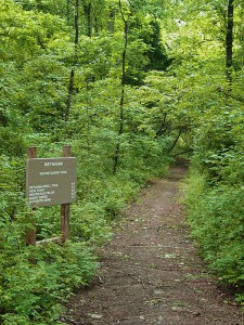
The Bethania Knoll Trail leads right and goes 400 feet to a viewpoint on top of a high bluff on Bethania Knoll overlooking Muddy Creek. The 1.5 miles of trail distance include 800 feet of walking to the Bethania Knoll viewpoint and back.?Continue on the Reuter Survey Trail by turning left at the trail intersection.?After 400 more feet, reach an old logging road and turn right. Head downhill, bear right at the bottom of the hill, cross a bridge across a small stream and at 0.6 miles, reach the start of the loop and soon pass the “Reuter Old Fields†sign.
This area was once in the heart of the “strip fields†surveyed by Reuter in this portion of the Muddy Creek flood plain. Originally, the Moravian Church owned the land and one field was assigned and leased to each family in Bethania, assuring that each family shared equally in the best and most productive farm land in the fertile flood plain of Muddy Creek. The strip fields were reached from the homes in the middle of Bethania by following “alleyways†that led between other fields.
Archaeologists have also determined that 10,000 years ago, early Native Americans used this same bottom land in this vicinity as the site for camps where they would hunt and gather mussels for food from nearby Muddy Creek.? Continue straight through the pines and follow trail signs as you walk the loop portion of the trail.
At 0.75 miles, reach a short side trail that turns left and goes to the top of the bank of Muddy Creek.
Continue on the Reuter Survey Trail by turning right at the intersection with the short side trail to Muddy Creek.
At 1.05 miles, reach the end of the loop portion of the trail.?From here, turn left, retrace your earlier route and return to Bethania Road, reaching the road after walking 1.5 miles.